
Chicago: the blue team's masterpiece
Whenever gerrymandering sounds like a red-state sport, Illinois is the answer. Democrats won the state with 57 percent of the vote and drew themselves fourteen of its seventeen seats.
The 2021 map, below, does it with districts that reach out of Chicago like tentacles, each carrying a bundle of city votes deep into the suburbs and cornfields.
Twelve of the seventeen districts crowd into Chicagoland, zoomed below, and that metro is your board. Among them sits a piece of gerrymandering history: the 4th District, the famous 'earmuffs', joins two mostly Latino neighbourhoods by a thin ribbon of highway so that one district, not two, elects their candidate.
The map delivered exactly as designed, fourteen to three in 2022 and again in 2024. When the mid-decade redistricting fight broke out in 2025, national Democrats pressed Springfield to squeeze out a fifteenth seat; the legislature looked at its own handiwork and declined to push further.
You are playing the Republicans in the blue team's own fortress, and fair warning: nobody has ever done this in real life. No known map of a two-to-one metro hands red a majority of its twelve seats. But this board simplifies Chicagoland into a grid of houses, and on the grid a winning map does exist. Nearly every red house has to count. Draw seven red districts out of twelve, if you can.
Biden 57.5%, Trump 40.6%. Illinois's 2020 presidential vote.
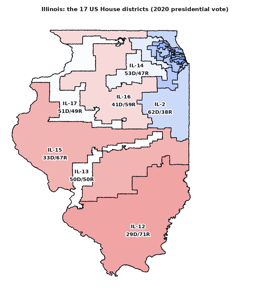
The 2021 map, shaded by the 2020 vote: spidery districts reach out of Chicago to swallow red suburbs, leaving Republicans three seats of seventeen in a state where they win four votes in ten.
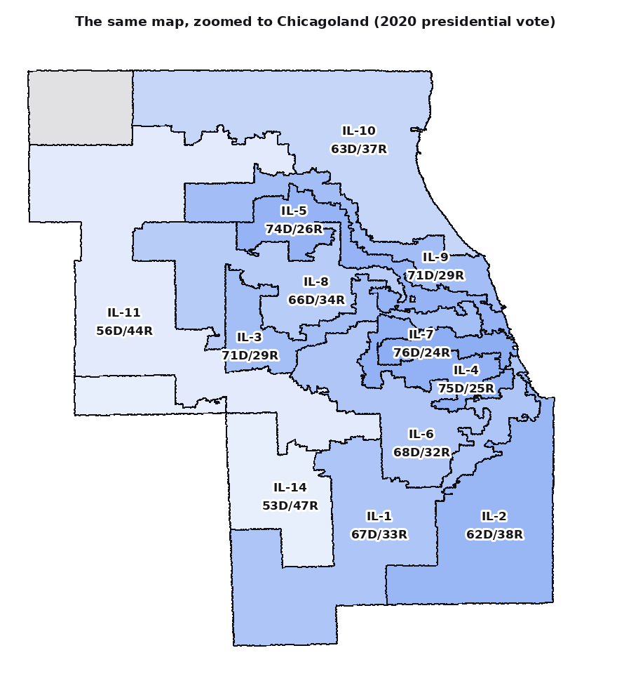
Chicagoland close up: twelve districts share the metro, and the 4th's famous earmuffs join two Latino neighbourhoods with a ribbon of highway.