
Milwaukee: packing the blue city
Wisconsin is one of the most evenly split states in the country, decided by a point or two in most statewide races.
But its Democratic voters are packed into two cities, Milwaukee and Madison, while Republicans are spread across the suburbs and countryside. That geography makes the state unusually easy to gerrymander: pack the cities tight and you can win most of the districts with a minority of the votes.
This board is the Milwaukee metro, the city plus the 'WOW' suburbs of Waukesha, Ozaukee and Washington. The city votes better than two-to-one Democratic; the WOW counties vote roughly 60 percent Republican. Overall the region is about 54 percent Democratic in two-party terms, yet the way the lines are drawn decides who actually wins.
You are playing the Democratic side. Your voters are about 54 percent of the metro, but they are stacked in the city where that majority is easy to waste. Can you draw the lines so the majority actually wins a majority of the districts, instead of being packed into a handful?
Clinton 46.5%, Trump 47.2%. Wisconsin's 2016 presidential vote. The grey sliver is other candidates.
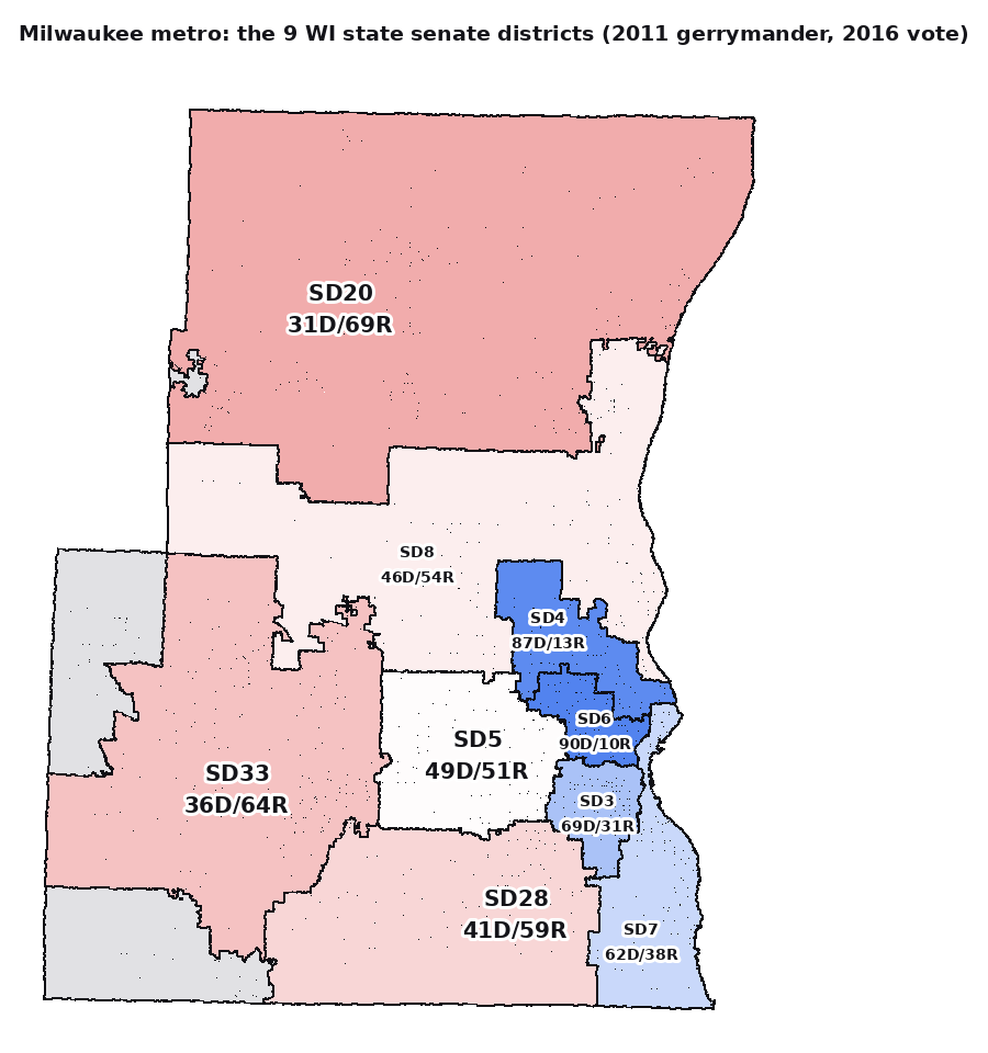
The metro's nine state senate districts (2011 map, 2016 vote). Democrats sit packed in the small lakefront districts; the grey slivers are neighbouring districts from outside the metro.