

Austin: the most cracked city in America
Travis County, the heart of Austin, votes about 71 percent Democratic in two-party terms. For a decade the city held a strange title anyway: the largest in America without a congressional district of its own.
The 2011 Texas map carved the city into six districts, five of them slicing Travis County alone, as the map below shows, each fanning out from a wedge of Austin into seats anchored in the Hill Country, the Houston suburbs or San Antonio. Under those lines only one, the 35th, a thin strip down Interstate 35 to San Antonio, reliably elected a Democrat. Austin only got an anchored seat of its own, the 37th, in the 2021 redraw, once packing the city had become more useful to the mapmakers than cracking it.
You are playing the Republicans who drew the 2011 map. Slice Austin apart, lash each wedge to enough red countryside to drown it, and win most of the districts in a region the city's voters should dominate.
Clinton 65.8%, Trump 27.1%. Travis County's 2016 presidential vote.
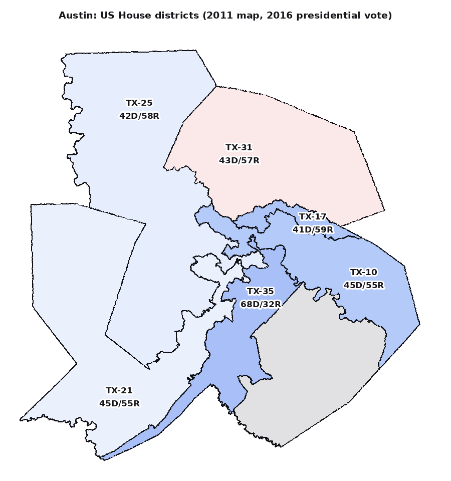
Five districts slice Travis County (2016 vote). The slices read blue, the labels read red: every seat stretches away from Austin into Republican countryside.
Texas's 35th congressional district (Wikipedia)
Texas's 37th congressional district (Wikipedia)
District & election data: MGGG-States / Texas Legislative Council / US Census, under ODbL 1.0.