

Kansas City: the crack voters get to veto
Kansas City is Missouri's blue metro. Jackson County votes 60 percent Democratic, and for two decades the city sat almost whole in the 5th District, which sent Emanuel Cleaver, its former mayor, to Congress ten times.
Under the map below, drawn after the 2020 census, that was still true: the 5th kept the city and leaned blue, and the 4th and 6th wrapped around it through the countryside.
Then, in September 2025, Missouri redrew its map mid-decade with no new census, as part of the national redistricting fight that started in Texas. The new map, below, cracks Kansas City among all three districts, and every one of them now leans Republican.
Missourians pushed back: a referendum campaign collected over 305,000 signatures to put the map itself on the November 2026 ballot. The state supreme court let the new lines stand for the midterms while that plays out, so this crack, unusually, may end up judged by the very voters it divides.
You are playing the Democrats. Kansas City's three-to-two majority in Jackson County is cracked three ways and drowned in red countryside. Draw the three districts so the city's votes win a majority of them.
Biden 60%, Trump 38%. Jackson County's 2020 presidential vote, Kansas City included.
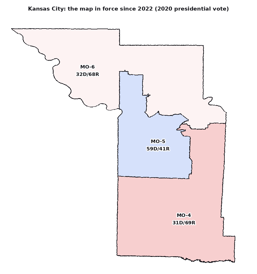
The Kansas City area under the map in force since 2022, shaded by the 2020 vote: the 5th holds the city and votes blue, while the 4th and 6th take the countryside.
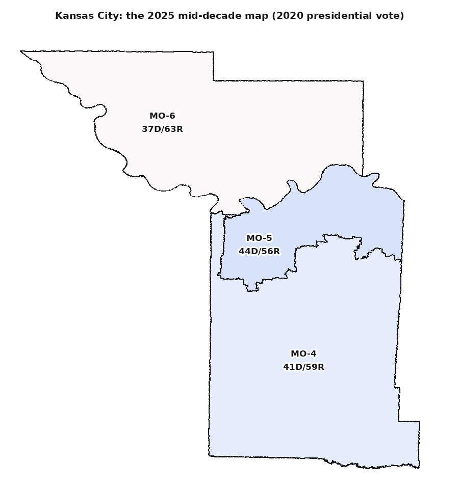
The 2025 map: Kansas City is split three ways, and each piece is stretched into enough red countryside that no district leans blue.
Missouri Congressional Map Referendum (Ballotpedia)