

Massachusetts: where the monster was born
Every map in this collection descends from one signature. In February 1812, Governor Elbridge Gerry of Massachusetts signed a redistricting law drawn to keep his party in the state senate.
One district curled through Essex County so grotesquely that a cartoonist gave it wings and claws, below, and the Boston Gazette christened the beast after its father: the Gerry-mander.
It worked, and it cost him. That April the opposing Federalists won the senate vote, 51,766 to 50,164, and took eleven seats to twenty-nine. Gerry himself lost the governorship the same day. The word has outlived them all.
Two centuries later, Massachusetts is the strangest ending the story could have: nine districts, below, all nine Democratic. Mathematicians, fittingly at a group founded to study gerrymandering, proved why the real map has no other side: the Republican third of the vote is spread so evenly across the state that in some recent elections no map, however it is drawn, elects even one Republican to Congress, and no map at all elects a red majority. The state that invented the gerrymander no longer needs one.
You are playing the Democrats in the state where it all began, with a two-to-one majority and two hundred years of practice. Sweep as many of the nine districts as you can; the real map takes all nine.
Clinton 60.0%, Trump 32.8%. Massachusetts's 2016 presidential vote.
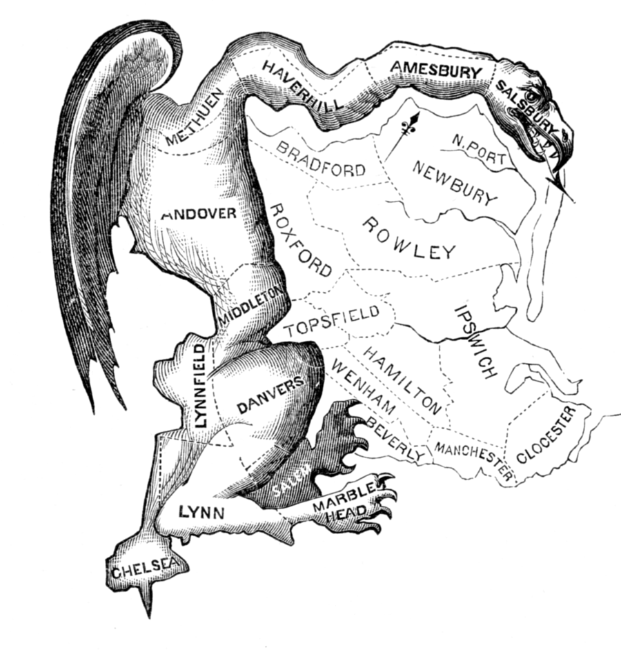
Elkanah Tisdale's 'Gerry-Mander' (Boston Gazette, 1812): the Essex County senate district, with wings and claws added. The cartoon named the practice.
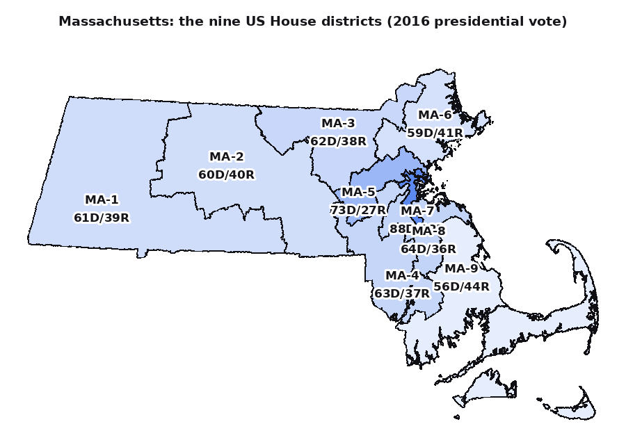
Massachusetts today, shaded by the 2016 vote: nine districts, every one of them blue.
1812 Massachusetts gerrymander (Wikipedia)