

Salt Lake City: a blue city with no blue seats
Salt Lake City is a Democratic island in a deeply Republican state: the county votes about 54 percent Democratic in a state that is anything but.
Its lines are a textbook case of cracking, the opposite of packing. Rather than concentrate the city's Democrats, Utah's map slices Salt Lake County three ways, as the map below shows, lashing each piece to enough red countryside to drown the city's votes.
The result: the county's majority elects essentially no Democrats to Congress. Every district that touches Salt Lake City reaches far enough into the red countryside to outvote it.
It took nearly a decade to undo. Utah voters passed an anti-gerrymandering initiative in 2018; the legislature worked around it, and the fight went to court. In late 2025 a judge threw the map out and imposed one that keeps Salt Lake County nearly whole, creating a safe Democratic seat, and Utah's supreme court let that ruling stand in February 2026. The map above is the earlier cut of that crack; the 2021 redraw went further still and sliced the county a fourth way, before the courts ended it.
You are playing the Republicans. Crack Salt Lake City apart, splitting its Democrats across districts so each stays red, and shut a 54-percent-Democratic county out of every seat.
Clinton 41.5%, Trump 32.6%. Salt Lake County's 2016 presidential vote. Most of the grey is independent Evan McMullin.
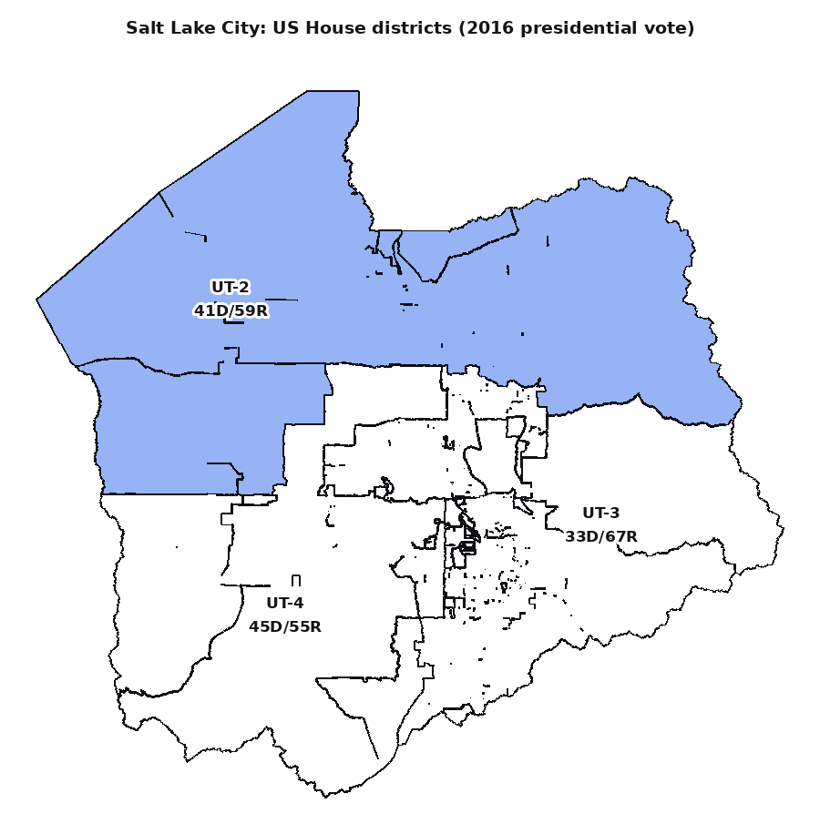
Three districts split Salt Lake County (2016 vote). Blue-ish inside the county, yet every label is red: each seat runs into countryside that outvotes the city.
Redistricting in Utah (Wikipedia)
District & election data: MGGG-States / Utah Legislature / US Census, under ODbL 1.0.